Geography
Overview
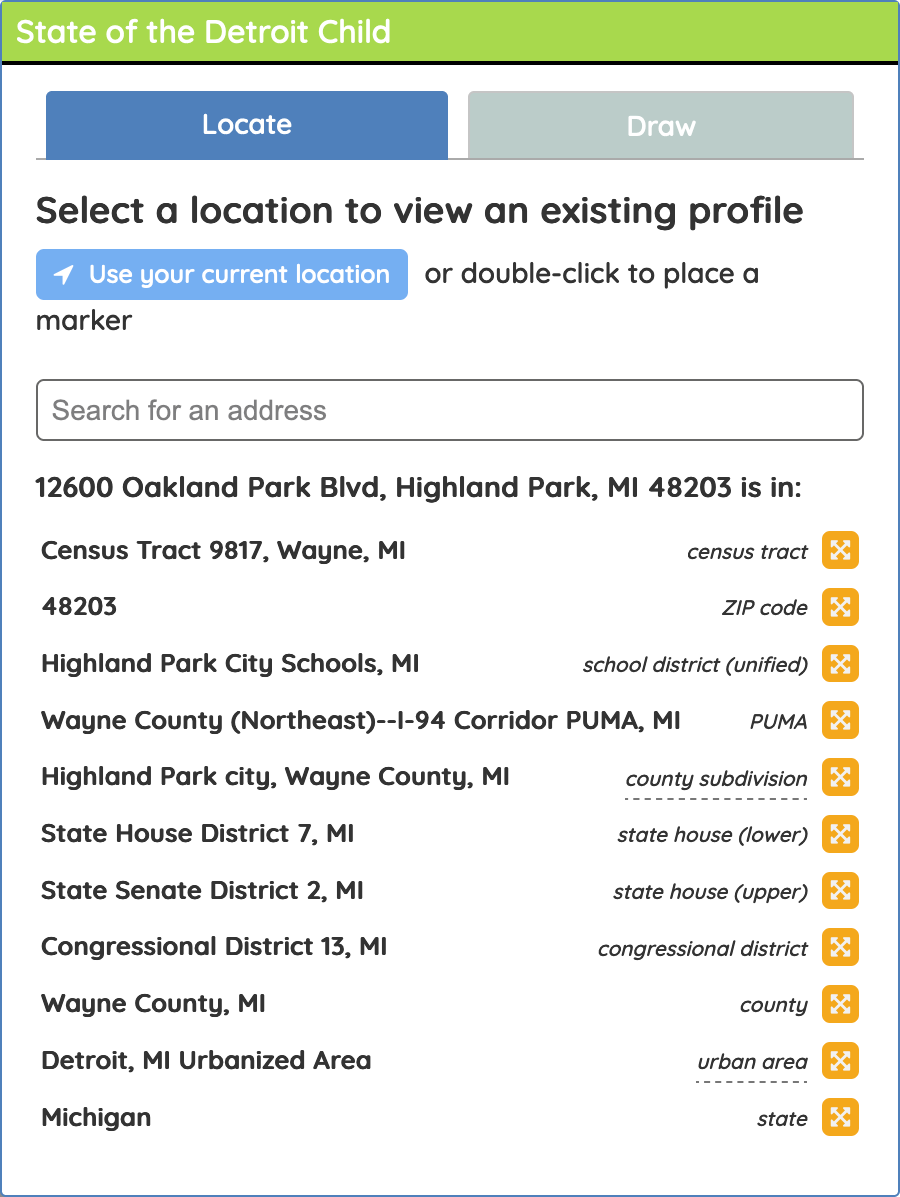
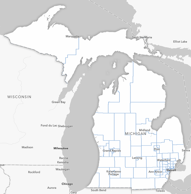
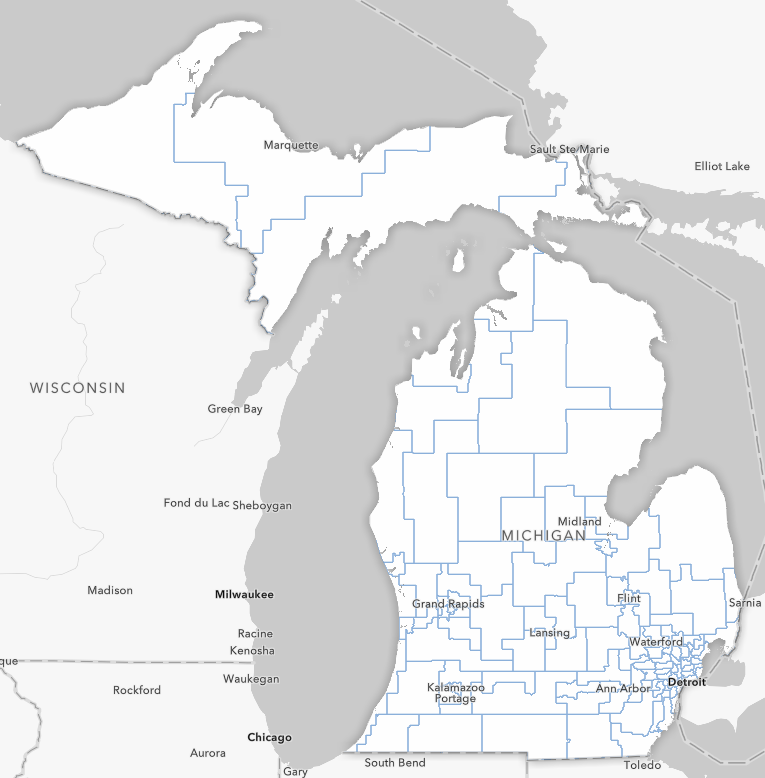
Geography is fundamental to the Census Bureau’s process of tabulating data, and is the backbone of data profiles on the State of the Child tool. The different geographic levels available in State of the Child are from a selection of the Census Bureau’s options. Some of these geographic areas may be familiar while others may need a little more explanation, and understanding each of them can help you utilize the tool to get the best data for your needs. When creating your data profile using the Locate method, you’ll be asked to select from one of 13 geographies that contains the location you selected. If you use the Draw method, you’ll select your geographic level first.
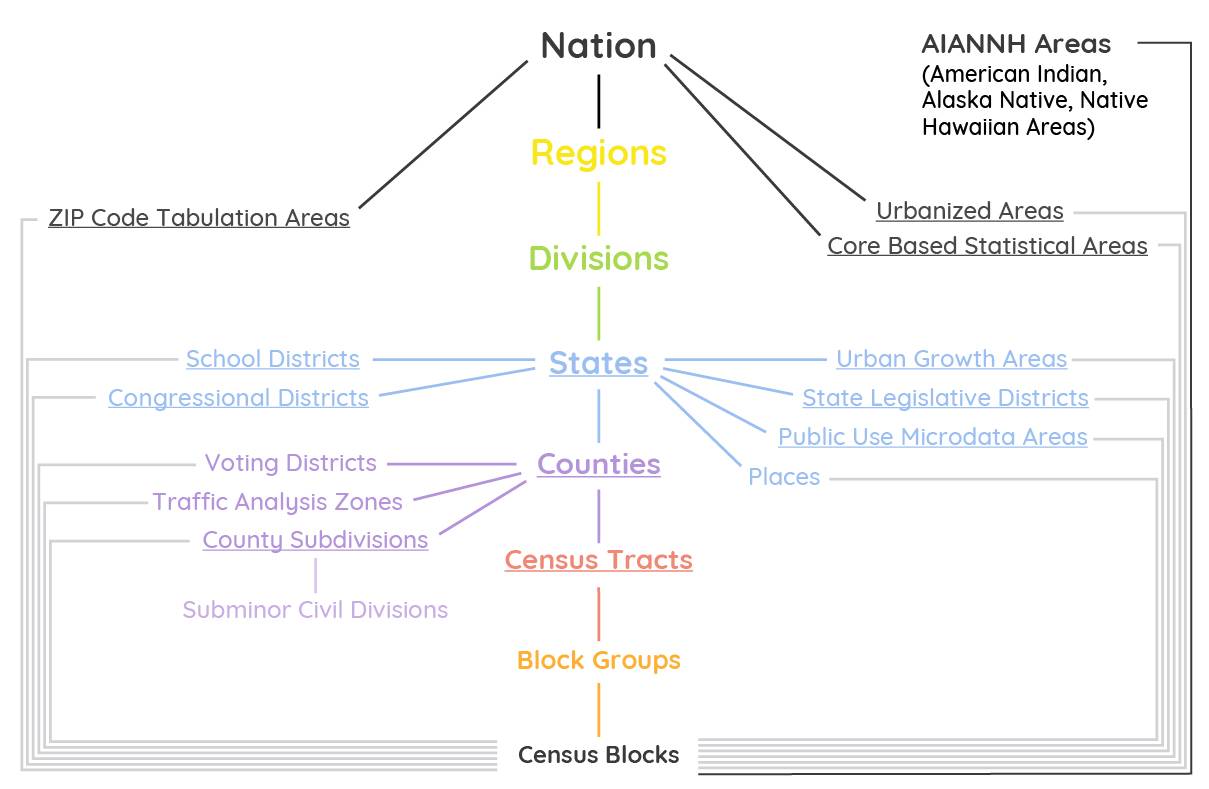
For privacy reasons, the Census Bureau doesn't release the raw responses to the American Community Survey (read our blog post on Data Privacy and the Census) to the public. Instead, the data is grouped into different geographic scales/areas referred to as summary levels. The summary levels generally increase in size from census block groups up to the nation (though SDC only has up to the state level) and generally incorporate various amounts of the smaller summary levels without splitting those smaller geographies. Within each summary level, geographic areas are distinct and don’t overlap each other. For example, no two census tracts cover the same geographic area, they are always adjacent to each other. Zip codes, on the other hand, will sometimes be split for larger geographies, especially those determined by state and local governments like school and congressional districts.
Summary Levels
The Census Bureau illustrates these in a “spine” that you can see below. The underlined levels are included in SDC.
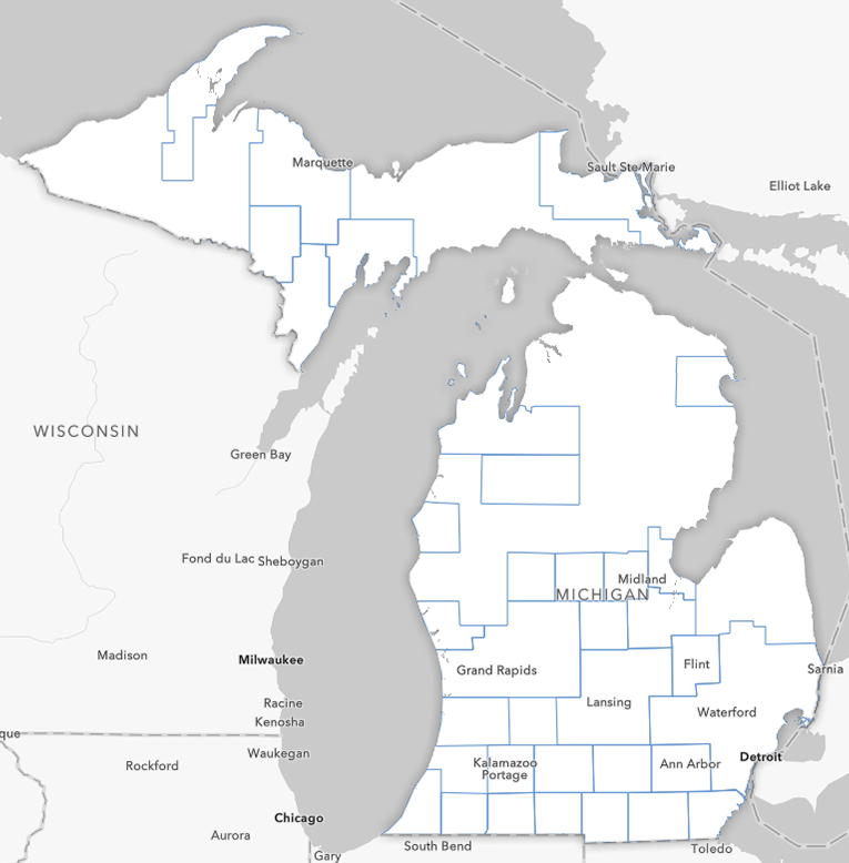
SDC Geographic Areas
In the order you’ll find these in the SDC geographic area tool: What are they, and why choose one or the other
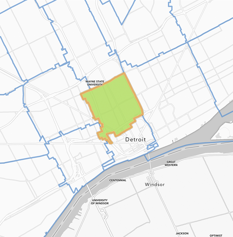
Census Tract
Census tracts are the smallest geography that we have available in SDC, though it comprises census block groups, which comprise census blocks. The population of blocks and block groups generally have too small of a population for us to provide data for. While tracts are a subdivision of a county, it can be roughly regarded as a neighborhood, as it generally has 2,500 to 8,000 residents and its boundary follows visible features like roads. In a municipality like Detroit, official or historic neighborhood boundaries don’t precisely follow census tract boundaries, but by selecting adjacent census tracts in SDC you can usually get an area that closely matches.
Many useful datasets are collected and summarized at the census tract level, including but not limited to, population characteristics, school enrollment, poverty level, median household income, housing vacancy, etc. This makes them useful for research, grant proposals, and grant reports. Census tract boundaries don’t stay exactly the same over time, and have only been universally applied in all US counties since 2000, so it can be difficult to make tract-level comparisons between Decennial Censuses. Read our blog post 2020 Census: Defining Census Tracts and Boundary Changes to learn more. GeoIDs for Census tracts start with 140.
Read our blog post 2020 Census: Defining Census Tracts and Boundary
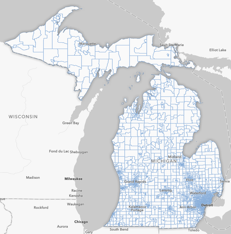
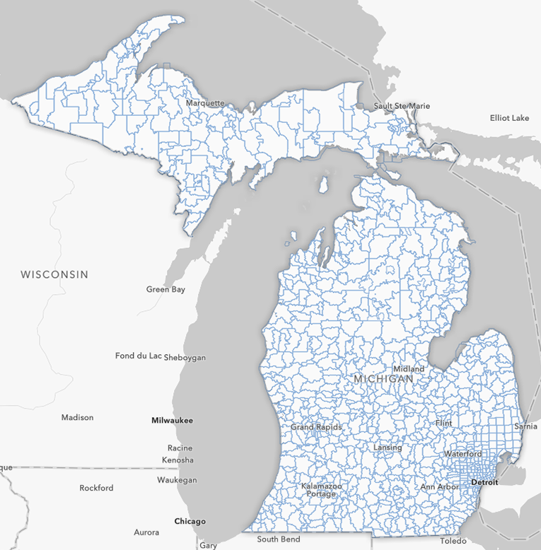
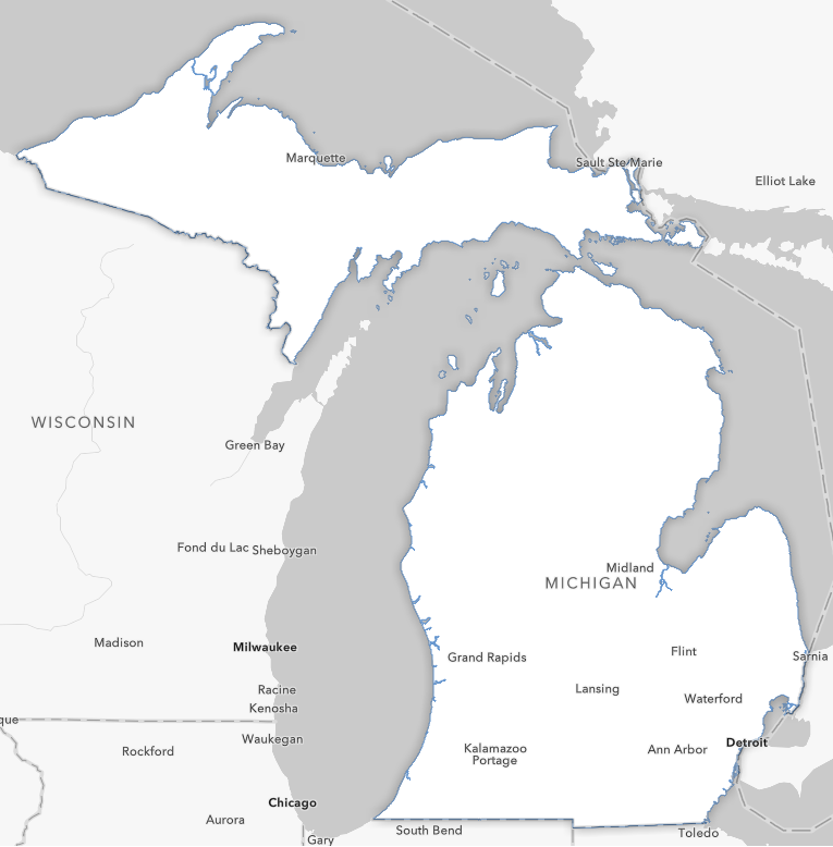
2020 Census Tracts in Michigan
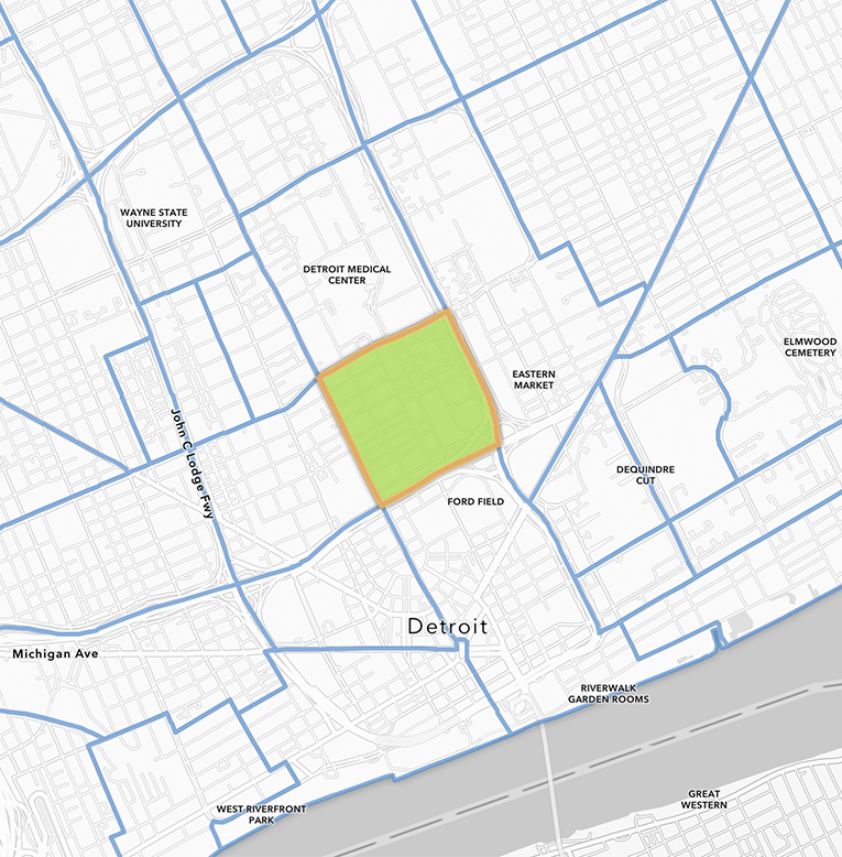
This Census Tract contains the block group of the late-childhood homes of Diana Ross and Smokey Robinson (who also lived near each other in the North End neighborhood as children).
Zip Code Tabulation Area
Zip codes are one of the more familiar geographic area divisions because people often know them as part of their address, but Zip Code Tabulation Areas (ZCTAs) aren’t the same as United States Postal Service (USPS) zip codes. The USPS defines zip code boundaries and changes them frequently, which makes them harder to compare over time. USPS zip codes can also contain only PO boxes that don’t cover a geographic area. The Census Bureau defines ZCTAs to be similar to zip codes, but they only cover geographic areas, resulting in fewer ZCTAs than zip codes. They are defined by aggregating Census blocks, and take the USPS zip code number that most of the addresses in those blocks use at the time of aggregation. ZCTAs don’t follow the same geographic boundary rules as some of the other geographic areas on SDC, as they can cross and split counties, county subdivisions, and census tracts.
Zip Code Tabulation Areas in Michigan
This Zip Code Tabulation Area contains the childhood homes of Diana Ross and Smokey Robinson.
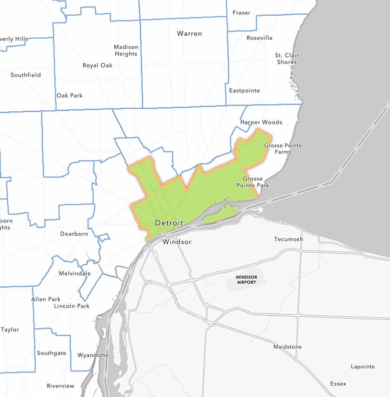
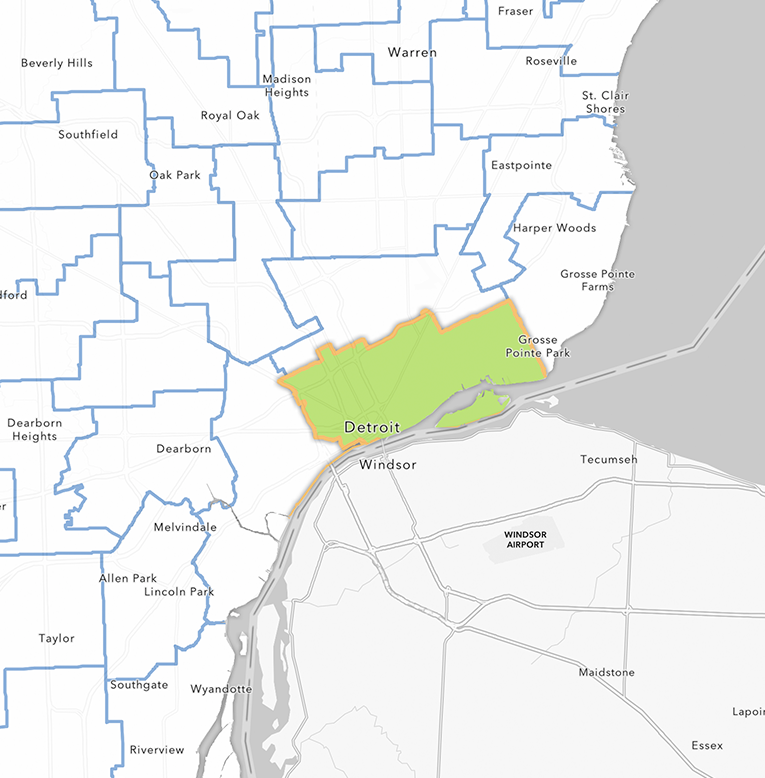
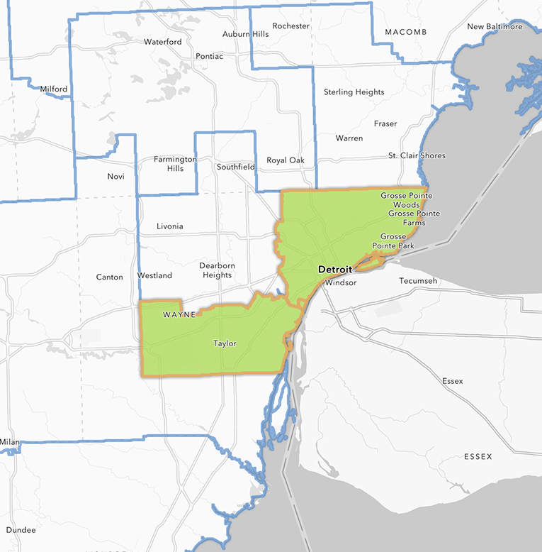
School District
With the child-focus of SDC, we have a lot of student-related data, so it can be particularly useful to use the school district geographic area. In some places like Detroit the district matches the city boundary, but other places are joined into a unified school district. Charter school districts, which tend to be just a building rather than a broader geographic area are not represented in SDC. Using school district level data can be useful for comparing student demographics, as student data in SDC is based on the students enrolled in the geographic area, not where the students live. With some districts in Michigan being school-of-choice, students can attend a district outside of the district covered by the geographic area they live in, making it very complicated to give student data based on their residence compared to the area covered by the location of the district they are enrolled in.
Public School Districts in Michigan
Here is the boundary of Detroit Public Community School District, that contains the zip code, census tract, and census block where Diana Ross and Smokey Robinson grew up, which in this case is the same as the boundary of Detroit.
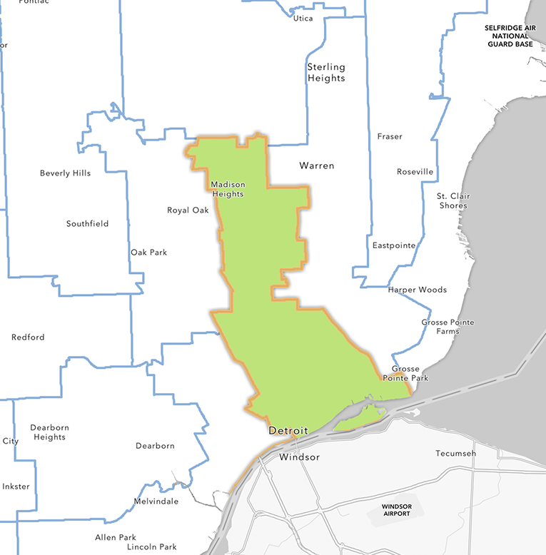
Public Use Microdata Area (PUMA)
Each year the Census Bureau releases American Community Survey 1-year estimate data for sub-state census areas with a population larger than 65,000, but existing state subdivisions like counties aren’t always above that threshold, so they only get included in 5-year estimates. Public Use Microdata Areas are a way for the Census to subdivide states into areas that are above that threshold, with each PUMA containing at least 100,000 people. There are 68 PUMAs in Michigan with an average population per PUMA of 148,196 people. While SDC only uses ACS 5-year estimates, PUMAs are still useful for geographies that are of similar populations.
Zip Code Tabulation Areas in Michigan
This Public Use Microdata Area contains the childhood homes of Diana Ross and Smokey Robinson.
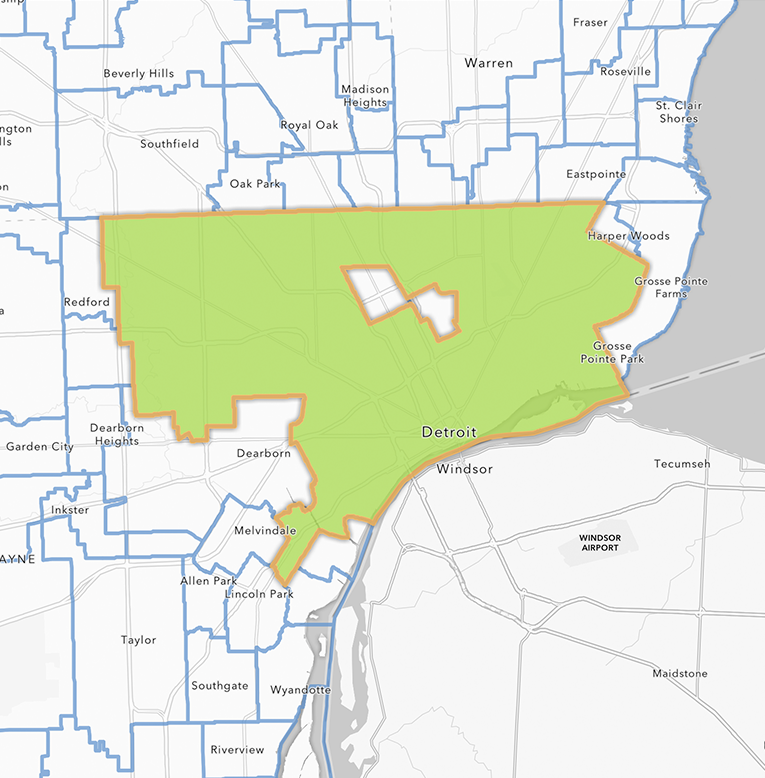
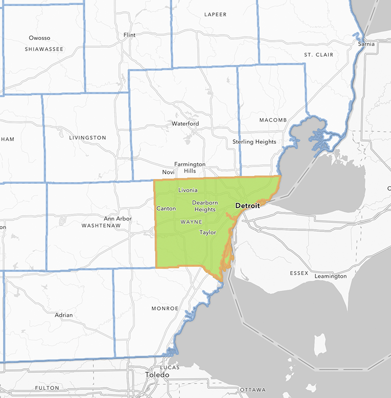
County Subdivision
One of the more common searches is for the local municipalities users are curious about, which will give the Michigan city or township that are contained within a county. These are captured by county subdivisions, which are generally municipalities or unincorporated areas within a county. There are a few cities like Northville that span two counties so it shows up as two separate county subdivisions, which can be solved using the Draw tool to create a custom geography that combines them.
Though we deemphasize them in SDC, the Census provides a similar geography to county subdivisions called Places. The main difference between the two is that when the municipal boundaries cross county lines there will be two county subdivisions related to that municipality and only one place. The other key difference is that county subdivisions are available for the entire map, and places are not, which is why we default to county subdivisions.

County Subdivisions in Michigan
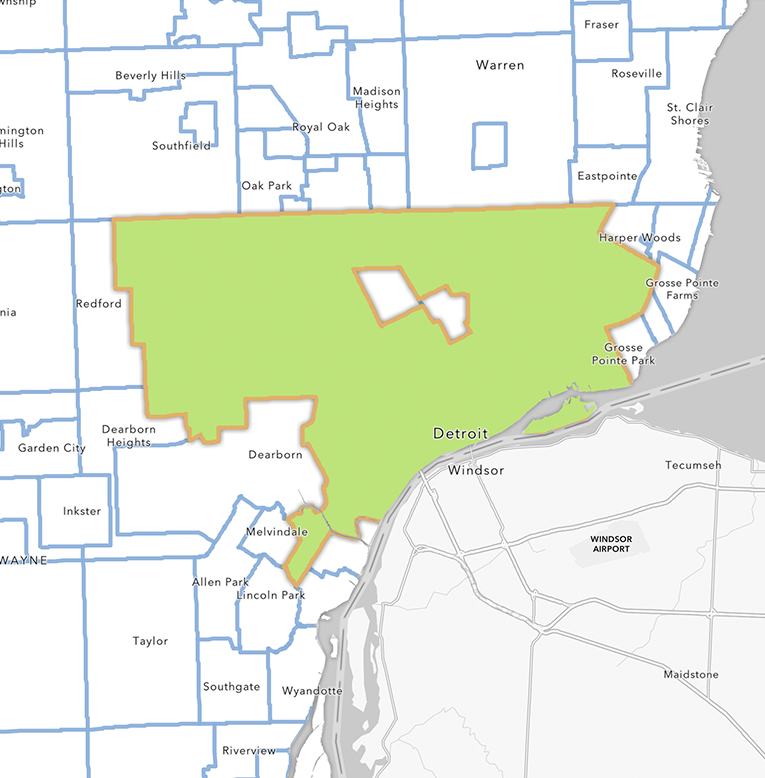
This County Subdivision (the City of Detroit) contains the childhood homes of Diana Ross and Smokey Robinson.
State House District
Use this geography level when you’re looking for data related to a State of Michigan House of Representatives district. As of redistricting after the 2020 census there are 110 districts, and each district has an approximate population from 77,000 to 91,000. Redistricting occurs after each Decennial Census which can change the districts in both count and area, making it difficult to compare congressional districts over long periods of time. Also known as the lower house of the Michigan Legislature, geoIDs for state house districts start with 620.
2020 State House Districts in Michigan
This State House District contains the childhood homes of Diana Ross and Smokey Robinson.
State Senate District
Use this geography level when you’re looking for data related to a State of Michigan Senate district. As of redistricting after the 2020 census there are 38 districts, and each district has an approximate population from 212,400 to 263,500. Redistricting occurs after each Decennial Census which can change the districts in both count and area, making it difficult to compare congressional districts over long periods of time. Also known as the upper house of the Michigan Legislature, geoIDs for state senate districts start with 610.
2020 State House Senate in Michigan
This State Senate District contains the childhood homes of Diana Ross and Smokey Robinson.
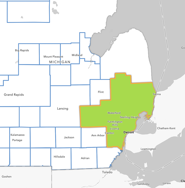
Congressional District
Use this geography level when you’re looking for data related to Congressional districts for the U.S. House of Representatives. As of redistricting after the 2020 census there are 13 districts in Michigan. Redistricting occurs after each Decennial Census which can change the districts in both count and area, making it difficult to compare congressional districts over time. Congressional district geoIDs start with 500.
2020 Congressional Districts in Michigan
This Congressional District contains the childhood homes of Diana Ross and Smokey Robinson.
County
Michigan’s 83 counties serve as local governments, they are often useful for data comparisons, research, grant reports, and grant proposals. GeoIDs for counties start with 050.
2020 Congressional Districts in Michigan
This County contains the childhood homes of Diana Ross and Smokey Robinson.
Urbanized area
Urbanized areas represent densely developed territories that encompass residential, commercial, and other non-residential urban land use areas. For the 2020 Census, as a general definition an area will qualify as urban if it contains at least 2,000 housing units or has a population of at least 5,000. Adjacent blocks can be combined into larger urbanized areas, though the inclusion or not of noncontiguous territories, group quarter blocks, and more has a lot of technical details you can read here in a comparison to the 2010 criteria.
Urbanized areas are less practical to use than Core-Based Statistical Areas (described below), which are based on counties, while capturing similar table values. However, because urbanized areas are decoupled from any administrative boundaries they can have better behavior in statistical models and be easier to compare to data from other countries.
Urbanized Areas in Michigan

This Urbanized Area contains the childhood homes of Diana Ross and Smokey Robinson.
Core-Based Statistical Area
Core-Based Statistical Areas (CBSA) are county-based geographies that comprise one or more counties around a core urban area which is the primary focus of economic activity for those counties. There are two types of CBSAs—Metropolitan areas and Micropolitan areas—and adjoining CBSAs can be combined into Combined Statistical Areas. CBSAs are built on Urbanized areas that have a population of at least 10,000, and the central counties of a CBSA have at least 50% of their population in an urban area of at least 10,000, or have within their boundaries a population of at least 5,000 located in a single urban area with a population of at least 10,000.
- Metropolitan Statistical Areas (MSAs) have at least one urban area of 50,000 or more population, plus adjacent territory that has a high degree of social and economic integration with the core as measured by commuting ties. Michigan has 15 metropolitan statistical areas as of 2020.
- Micropolitan Statistical Areas (μSAs) have at least one urban area of at least 10,000 but less than 50,000 population, plus adjacent territory that has a high degree of social and economic integration with the core as measured by commuting ties. The addition of these adjacent areas can take the population above 50,000. Michigan has 18 micropolitan statistical areas as of 2020.
In the case of larger cities, you could think of CBSAs as capturing a city together with its suburbs. Though the CBSA could include many municipalities, they all function together as an economic unit. In the case of smaller CBSAs, this might look more like a small or mid-sized city center along with the surrounding rural areas. CBSAs are especially useful because they are composed of counties, which simplifies making comparisons with historical data.
Urbanized Areas in Michigan
This Core-Based Statistical Area contains the childhood homes of Diana Ross and Smokey Robinson.
Available Summary Levels with codes
- Block Group (150)
- Census Tract (140)
- Zip Code (860)
- School District (unified) (970)
- School District (elementary) (950)
- PUMA (Public Use Microdata Area) (Doesn’t have summary level code)
- County subdivision (060)
- City
- Township
- State House (Lower) (State House of Representatives) (620)
- State House (Upper) (State Senate) (610)
- Congressional District (500)
- County (050)
- Urban Area (Doesn’t have summary level code)
- Metro Area (Metro/Micropolitan Statistical Area) (310)
- State (040)